City planners have a new tool at their disposal for mapping urban spaces – satellite data. While traditional methods such as manual photography and drones have been used in the past, satellite data offers unique benefits such as large coverage area, cost-efficiency, and high levels


La Bibliothèque, a renowned culinary destination in East London, has announced the appointment of Thomas Lemercier as their new Head Chef. The news was confirmed on Wednesday 5 June, 2024.Originally from Strasbourg, France, Thomas brings with him a wealth of experience from his culinary journey
Last Updated on: As the popularity of solar energy continues to grow, so too do the options for how to install and mount solar panel systems. One key factor in a successful solar installation is choosing the right type of ground mounting system.In this guide,

<?xml encoding="utf-8" ?????????>Every business grapples with a diverse range of financial challenges and no company is fully protected from cash flow issues, late invoice payments, and unexpected costs.Understanding these challenges is the first step in navigating them successfully and achieving business success.As James Robson, CEO,

BRP SIERRA MADRE, a marooned transport ship which Philippine Marines live in as a military outpost, sits on the disputed Second Thomas Shoal, part of the Spratly Islands in the South China Sea. — REUTERSBy John Victor D. Ordoñez, ReporterTHE PHILIPPINES should hold more dialogues

JULIAN CHRIST-UNSPLASHBy Kenneth Christiane L. Basilio and Kyle Aristophere T. Atienza, ReporterTHE NATIONAL Telecommunications Commission (NTC) should take down posts on X with sexual content, a congressman said on Wednesday, after the social media platform released a policy allowing adult content.“X and Elon Musk may
Coastline Housing, a social landlord in Cornwall, has announced the appointment of Francesca Rhodes as its new Chair. Rhodes, who joined the Board in June as Chair Designate, will be taking over from current Chair Steve Harrison upon his retirement in September.With 18 years of

A PHILIPPINE senator on Wednesday pushed the creation of a Center for Disease Control (CDC) after the Health department detected cases of the FLiRT coronavirus variant and Omicron subvariants in the country this week. “We are pushing for the establishment of the Center for Disease
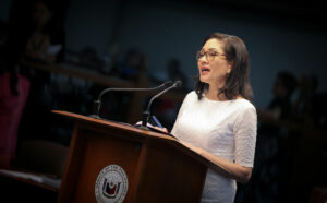
PHILSTAR FILE PHOTO/ SENATE PRIB/JOSEPH VIDALA SENATOR urged President Ferdinand R. Marcos, Jr. and his security advisers on Wednesday to ban Philippine Offshore Gaming Operators (POGOs), which she said could compromise national security due to links to international crime syndicates and spies.“We hope that the
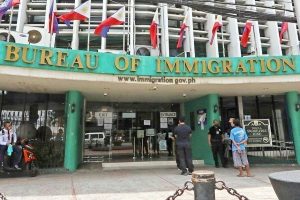
PHILSTARTHE BUREAU of Immigration (BI) on Tuesday arrested 37 Chinese nationals allegedly involved in illegal retailing by running grocery stores and restaurants inside the upscale Multinational Village in Parañaque City.“We received credible information about foreign nationals engaging in illegal retail activities, and our team acted

PHILIPPINE STAR/ MICHAEL VARCASPRESIDENT Ferdinand R. Marcos, Jr. declared June 17, which falls on a Monday, a regular holiday for the observance of Eid’l Adha or the Muslims’ Feast of Sacrifice, according to a proclamation he signed on June 4.More than six million of Filipinos
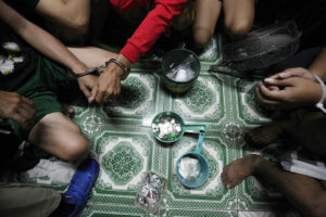
PHILIPPINE STAR/ MICHAEL VARCASRELATIVES of victims killed during the previous administration’s war on drugs were encouraged by a Manila congressman to file a class suit against implementers of the anti-drug campaign.“Convince the victims [or their surviving relatives]… to go to court as a class suit,”